Garmin BaseCamp enables outdoor enthusiasts to plan, manage, and analyze their GPS data using detailed topographic maps on a Windows PC. This trip planning software serves as the central hub for hikers, cyclists, and off-road explorers who need to organize routes, tracks, and waypoints before heading into the wild. By bridging the gap between your desktop and handheld device, it ensures you have precise navigation data ready for your next adventure.
Key Features
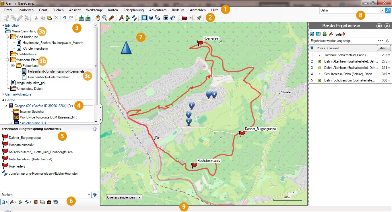
- 2D and 3D Map Viewing: Inspect terrain contours and elevation profiles in two or three dimensions to understand the difficulty of your planned path.
- Track Draw: Sketch your intended path directly on the map to estimate distance and elevation changes before you start moving.
- Geotagging Photos: Import your pictures and associate them with specific waypoints to create a visual memory map of your journey.
- BirdsEye Satellite Imagery: Transfer unlimited satellite images to compatible devices to see a true-to-life representation of your surroundings (subscription required).
- Adventure Playback: Replay your recorded routes and tracks on screen to review your performance or share the experience with friends.
- Offline Planning: Organize your data and view maps without an active internet connection, ideal for remote preparations.
Use Cases
This tool is essential for backpackers and hikers who need to scout water sources and campsites on topographic maps before leaving home. Motorcyclists and off-road drivers also rely on it to create custom routes that follow specific scenic trails rather than the fastest highway options.
Garmin BaseCamp remains the definitive choice for users of legacy and modern Garmin handhelds who demand granular control over their navigation data without relying on cloud-based services.
Version 4.7.5 — March 2023
- Implemented comprehensive maintenance updates to ensure continued system reliability.
- Improved overall application stability to minimize crashes and optimize performance.
- Fixed various miscellaneous bugs and internal errors affecting user experience.